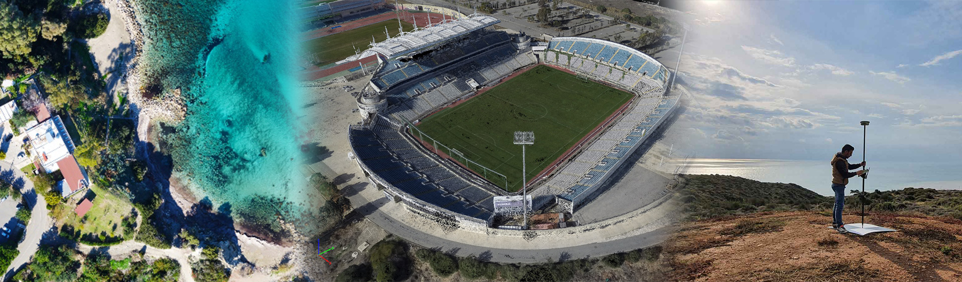
Products
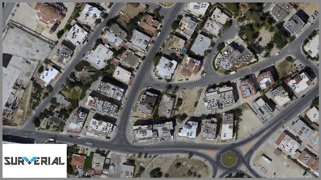
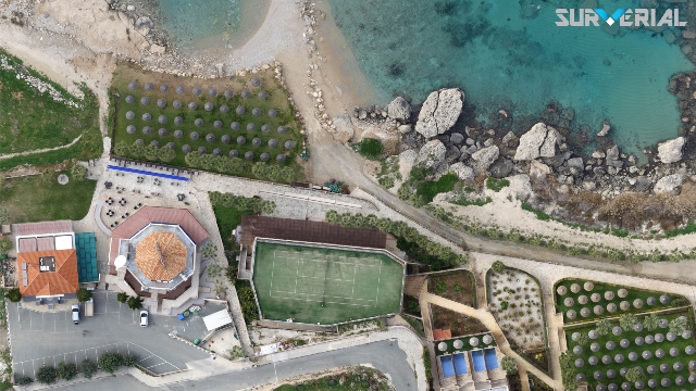
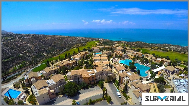
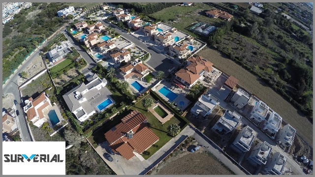
We produce high resolution and georectified True-Orthophotos at any given moment. Resolution of the imagery is up to 4cm/pixel and the georeferenced accuracy is up to 3cm (in WGS’84 & CGRS’93 LTM). To achieve such high accuracies we use a 1cm GPS system for ground control points (GCPs). Use our True-Orthophotos by overlaying vector maps or any other data to compare, design and take detailed length & area measurements or just design your own digital maps, monitor and manage environmental change, improve town planning, quantify and visualize. The application and capabilities are endless.
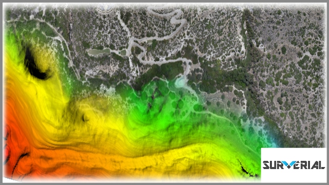
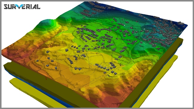
Surverial’s DEMs (Digital Elevation Model) acquired through techniques such as photogrammetry and land surveying. DEMs are used often in geographic information systems (GIS) and are the most common basis for digitally-produced relief maps. We use our DSM (Digital Surface Models) for landscape modeling, city modeling and visualization applications that we provide to our customers. We also produce DTMs (Digital Terrain Models) and are often required for extracting detailed contour lines, land-use studies, flood or drainage modeling, geological applications, and other applications, designed and delivered by customers specific needs.
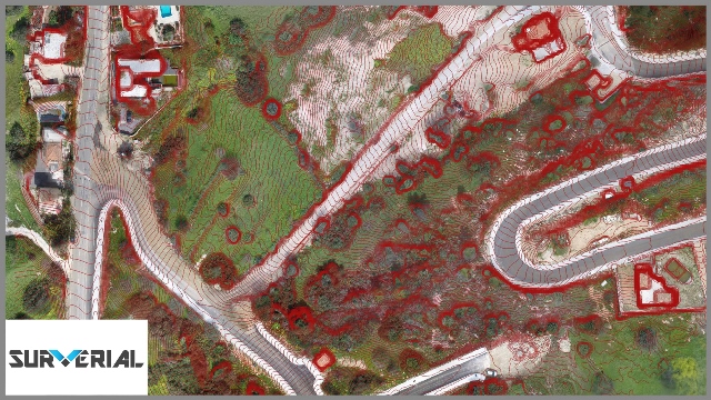
Surverial can provide you with very dense 3D Photo Point Clouds which can be generated from standard resolutions of aerial imagery/surveying.
A 10cm GSD (Ground Sample Distance) aerial survey flown at 80% forward and 70% side overlap can be used to generate a 100 points per sq m photo point cloud. Immerse in a virtual environment and simulate real world scenarios. Detailed measurements of lengths, areas and volumes but also calculation and extraction of XYZ coordinates from hundred of millions of highly accurate 3D points.
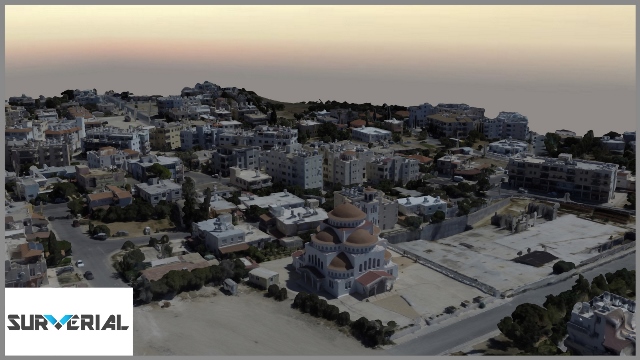
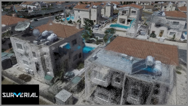
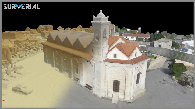
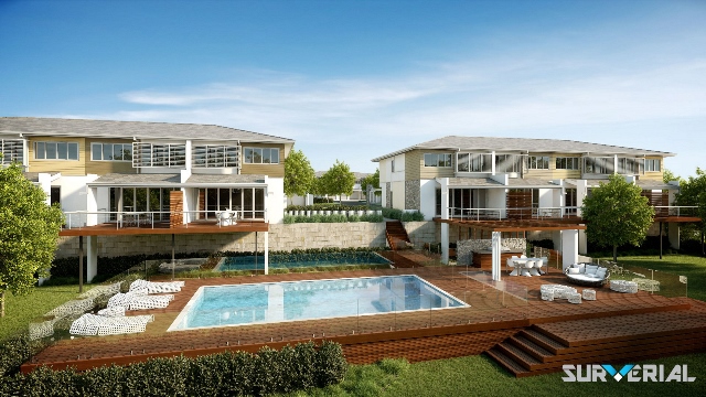
Surverial provides and deliver fully textured, geographically accurate and high-resolution 3D models which include all natural and man-made objects present in a scene.
The huge complexity, detail and accuracy contained in Surverial’s models, combined with the possibility to interact and extract real 3D information in both natural and built environments, can provide a valuable resource for many industries!
We carry out the production of :
– 3D Photorealistic Model of any region or any object (in .obj, .dxf, .las and many more other formats)
– complex 3D geoinformation pictures for reports, presentations and posters,
– fly-through for virtual tours, multimedia, web, corporate presentations,
– HD fly-through for publicity, advertising, TV and cinema
– and the production of 3D Stereoscopic fly-through and animations for 3D TV and cinema
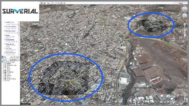
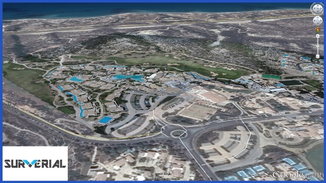
Surverial provides you with KML and HTML file so you can overlay the produced True – Orthophoto in Google Earth or in Google Maps. This way you can easily add detailed geospatial information for your studies and projects or just share with your clients and colleagues!
Services
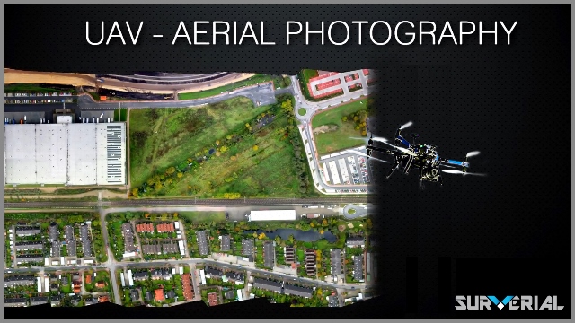
We provide comprehensive and professional Aerial & Land Surveying Services with our team of experts in digital photogrammetry, geomatics and surveying engineering. Our products from Aerial Mapping are:
-Georeferenced OrthoPhotoImagery
-Digital Elevation Models (DEMs)
-Contours Lines
-3D Feature Extractions
-Volumetric and Area Calculations
Each of our fully autonomous UAVs is able to map a 1 km2 area in about 60 minutes, from launch to recovery. That’s time and money saved!
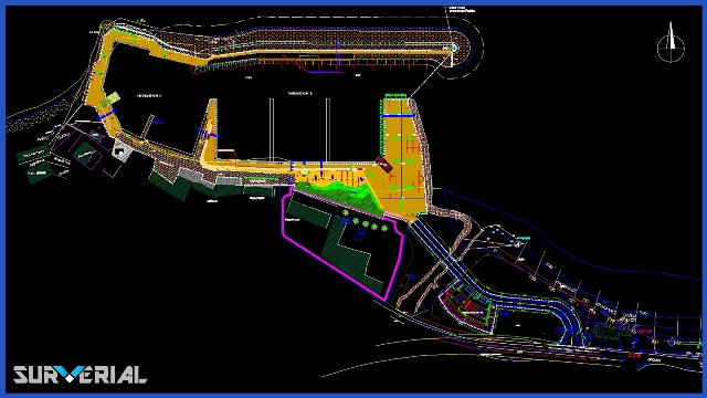
Surverial is designing and executing of full scale digital cartography projects. We combine the use of Vector and OrthoImagery data with DTMs to deliver the most amazing, detailed and accurate maps both in 2D or 3D visualization.
We producing georeferenced data and that means we can integrate them into GIS software for accurate mapping. Our GIS experience allow us to provide value added services including GIS analysis, volume calculations, area measurements, 3D visualizations, simulation and many more!
Movie producers and video game designers can rapidly import entire movie sets, characters and objects into various CGI platforms from our True 3D Models. This is considerably faster and in better detail than traditional techniques.
Surverial capabilities of 3D Photo Realistic Modelling allows producers to map out camera angles, special effects and storylines. Applying the techniques of computer-generated imagery (CGI) and virtual reality they can create never before seen effects within an incredibly short time and low cost!!
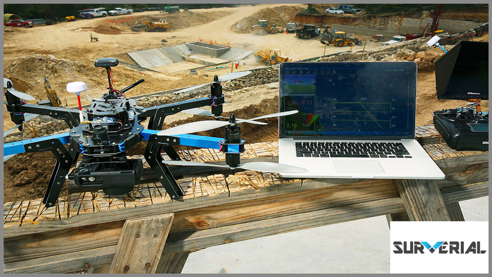
Professional drone aerial photography is about much more than just snapping a few photos or videos from the air. It requires a safe, reliable aerial platform for operating in often very confined spaces, a skilled drone operator, as well as the creative ability to capture truly amazing, unique angles of the objects of interest that will stand out from the crowd!
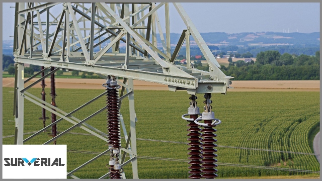
Aerial imagery can give to industry an easily attainable bird’s eye view of infrastructure. Using the aerial photo or video combined with the live view monitor (FPV) we can inspect a building, a bridge, a high electrical pole etc.
GLOSSARY
- Orthophotomap : Vertical photographs are often used to create orthophotomap, alternatively known as orthophotos. In other words, an orthophotomap is a simulation of a photograph taken from an infinite distance, looking straight down to nadir. High buildings facades can obscure the ground in regular orthophotos. Our “True” Ortho product is free of distortions caused by buildings. This is useful where building lean can obscures the ground. Nadir True Ortho products are ideal for mapping.
- GCP (Ground Control Points): Points in three dimensions which is measured and can be represented by (X,Y,Z) coordinates based on cartographic projection and grid system. GCPs used in geometric correction of distorted images, and their transformation to a convenient map projection. To generate geographically accurate data, precise GCP (ground control points) are integrated into our processing chain measuring them with high accurate topographic instruments (Leica Systems GPS 1200)
- GSD (Ground Sample Distance) : in a digital photo (such as an orthophoto) is the distance between pixel centers measured on the ground. For example, in an image with a one-meter GSD, adjacent pixels image locations are 1 meter apart on the ground.
- Google Earth: KML, or ‘Keyhole Markup Language’, is an XML grammar and file format for modeling and storing geographic features such as points, lines, images, polygons, and 3D models for display in Google Earth, Google Maps and other applications. You can use KML to share places and information with other users of these applications. A KMZ file is a compressed version of a KML file. Google Earth can open KML and KMZ files if these files have the proper file name extension (.kml or .kmz).
- Contour Lines: A line on a map joining points of equal elevation above a given level, usually mean sea level. The change in elevation between one contour line and the next is the contour interval.
- Digital Terrain Model (DTM): The representation of a bare-earth model that contains elevations of natural terrain features where vegetation, buildings and other non-ground objects have been digitally removed.
- Digital Surface Model (DSM): Represents earth surface which includes the buildings, vegetation and all other manmade structures.
- 3D Point Cloud: Very dense 3D photo point clouds equivalent or higher to that of airborne LiDAR which can be generated from standard resolutions of imagery. For example, a 10cm GSD (Ground Sample Distance) survey flown at 80% forward and 70% side overlap can be used to generate a 100 points per sq. m photo point cloud.
- Photorealistic 3D models: Are generated using advanced acquisition and photogrammetry techniques that extract accurate geometric information from aerial and ground photographs. Extremely dense 3D point clouds are generated prior to being transformed into a fully-textured mesh object.